2019 Central Wasatch Trail Work Summary
Now that 2019 is in the rear view mirror, let’s take a step back to appreciate all of the hard work, community organizing, and elbow grease that has contributed to the maintenance and expansion of the trails we love in the Central Wasatch.

Photo from SLC resident, Jon Lykins.
Millcreek Canyon
Big Water to Elbow Fork Connector Trail:
Elbow Fork is located about 8 miles up Millcreek Canyon. This new section of trail was designed to connect people to the Pipeline trail when they are coming from Big Water and Elbow Fork in Millcreek Canyon. It is designed to help people avoid riding or hiking down the road in the upper section of the canyon, increasing the safety on the road. Trails Utah can be credited in securing the funding and work crews needed to complete this project. Work is slated to continue next season.
Bowman Fork Trail:
The Forest Service and Trails Utah completed a major trail tread repair effort along the Bowman Fork Trail between the Terraces picnic area and Alexander Basin. The trail tread considers the width, cross slope, surface drainage, and smoothness or compactness of the surface to optimize its longevity and use.
Rattlesnake Gulch Trail:
Trails Utah is leading the effort in planning and preparing for a reroute of this popular trail near the mouth of Millcreek Canyon. Read more about this project here.
Upper Pipeline & Great Western Trail Connector:
This three mile section of trail will connect the Elbow Fork trailhead and Big Water Trailheads with other mid-canyon access points. The project began last year and will continue once other resources are identified. You can read more about this project here.
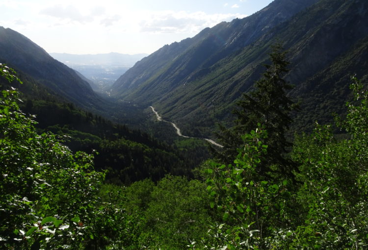
Photo by Carly Lansche
Little Cottonwood Canyon
Red Pine Lake Trail:
Two sections of the trail to Red Pine Lake, one above and one below Maybird Junction, were rerouted this year. The intent in rerouting these trails is to bring the upper section to a more sustainable grade, while rehabilitating the original trail alignment. It became steep and eroded since the original development of the trail. Salt Lake Ranger District hired the Utah Conservation Corps, with funding support from Trails Utah to complete this realignment. The Cottonwood Canyons Foundation also lent a hand in completing the on-the-ground work.
Albion Meadows Extension:
With the help of Alta Ski Lifts and the Alta Environmental Center, a new trail was built to connect the Albion Meadows trail to the Catherine Pass trailhead. Part of the reason for its construction is to eliminate the trampling of wildflowers. A small section, made of a rock staircase, will link the end of the trail to the parking lot adjacent to Catherine’s Pass trailhead. The name of this trail is still undecided.
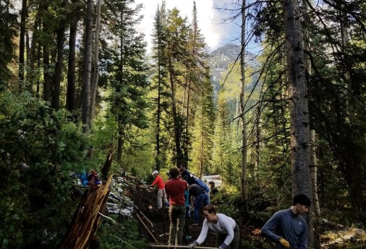
CWC staff and volunteers helping with the Donut Falls Connector trail work to celebrate National Public Lands Day.
Big Cottonwood Canyon
Cardiff Fork/Donut Falls Connector Trail:
This year a connector trail was completed between the Donut Falls trailhead and the Mill D North/South parking lot. The purpose of this trail is to direct recreators away from the adjacent road to promote safety, as high volume of visitors can create dangerous congestion in this area. This one-mile-segment of trail took about three years to complete and was worked on by the Salt Lake Ranger District and Cottonwood Canyon Foundation trail crews.
With the help of REI and other partners, Cottonwood Canyon Foundation hosted a National Public Lands Day volunteer event this November, including Central Wasatch Commission staff and volunteers! The volunteer power helped supply the labor needed to complete the one-mile trail segment. Additional funding to make this project come to life came from Salt Lake County’s Recreation Trails Program.
Cardiff Bridge and Boardwalk:
The Donut Falls Trailhead sees hundreds of visitors, many of whom are families, throughout the year. When walking from the Cardiff parking lot to the trailhead, the congestion on the roadway is becoming a safety concern. The Salt Lake Ranger District, Salt Lake County, and the Big Cottonwood Community Council are working together to fund a solution to this issue. Their project goal is to separate the recreationalists from the vehicular traffic through two phases:
Phase 1: Install a natural surface, “stroller ready trail” that extends from the Cardiff meadow to the Trailhead. This was completed this year, and is mentioned above.
Phase 2: Complete a 100’ bridge over Big Cottonwood Creek and a boardwalk over the riparian, meadow to protect the sensitive wetland and watershed quality. Efforts to coordinate the logistics for phase two are currently underway, which includes helical test piers for the boardwalk, and geotechnical surveys to determine the bridge abutment.
Mill B North:
With the help of REI funding, four weeks were spent rehabilitating the first quarter mile of the Mill B North trail. Stone steps were installed and a small reroute was constructed to mitigate future erosion and make the trail safer. These improvements are within the first quarter mile of the trial. The project was lead by the Cottonwood Canyon Foundation.
General Central Wasatch Updates

Photo by Jo Savage Photography.
Bonneville Shoreline Trail:
Tracing the banks of the ancient Lake Bonneville, the Bonneville Shoreline Trail is designed to be a contiguous 280 miles in length. Once fully completed, it will connect the border of southeastern Idaho to the town of Nephi. The implementation of regional trails is a long, complicated process. The perfect synergy of land management consensus, funding, and political will has to come together to make the segmented wins happen.
This year, the Salt Lake Ranger District of the U.S. Forest Service worked with funding from Salt Lake County’s General Fund to begin work on continuing the trail from the mouth of Big Cottonwood Canyon to Ferguson Canyon. It is slated to be completed in 2021.
Take a look at this map to see the alignment for this new segment of the BST here.
Guardsmans Pass Improvements:
Mountain Trails Foundation and its partners, including Utah Open Lands, were busy making improvements to Guardsman Pass parking lots and trailheads. Next season you will find four new parking lots, three pit vault toilets, and improved signage to better direct people on the trail. New trail connections were in the works in the summer of 2019 and will continue when the snow recedes in 2020.
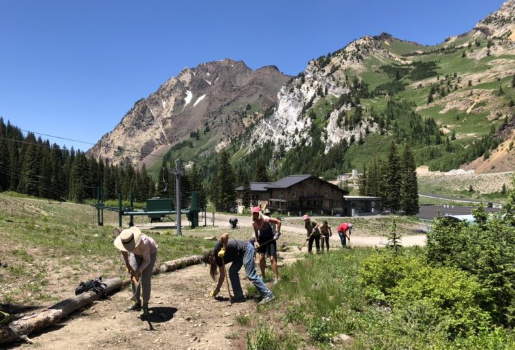
Photo generously provided by Cottonwood Canyons Foundation.
Adopt-A-Trail Program Success:
Most of the land that our beloved trails traverse through in the Central Wasatch is managed by the U.S. Forest Service. In many states, the U.S. Forest Service hosts an Adopt-A-Trail program so that organizations can help sustain on-going trail work through financial support or committing volunteer labor. This year, the Uinta-Wasatch-Cache National Forest tested out its first pilot Adopt-A-Trail program with the help of the Cottonwoods Canyon Foundation. This program helped free up the Forest Service’s limited staff time and budget to tackle larger, higher priority projects.
Patrick Morrison, the Trails Director for Cottonwood Canyons Foundation, has poured countless hours into helping the greater Central Wasatch community “adopt” some of the trails in the Central Wasatch — making the pilot a success. The pilot-program recruited the help of 136 volunteers.
With his help, the Cottonwood Canyons Foundation promoted the adoption and stewardship of five trails:
| Trail | Adoptor |
| Lake Blanche | Backcountry.com |
| Red Pine Lake | Backcountry.com |
| Mill B North | REI |
| Mill D North | Cotopaxi |
| Neffs Canyon | Mount Olympus Community Council |
Regional Foresters Award:
The USDA awards community efforts and organizations for exceptional work within U.S. Forest Service regions. The Central Wasatch falls into the Intermountain Region, or Region 4, of U.S. Forest Service managed lands. This year, the Recreation-Access-Infrastructure award recognized the Graffiti Abatement effort in the Central Wasatch. It recognized the collaborative approach between partners to eliminate graffiti from the National Forest System Lands.
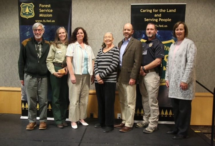
2019 Regional Foresters award recipients, photo from the Salt Lake Ranger District.
Partners recognized include: Bekee Hotze – Salt Lake Ranger District; Marshall Alford – Salt Lake Ranger District; Serena Anderson – Cottonwood Canyons Foundation; Dave Fields – Snowbird; Mary Young – Friends of the Salt Lake Ranger District; Scott Whipperman – Graffiti Busters; Peter Lenze – Graffiti Busters; Sgt. James Blanton – Unified Police Department; Julia Geisler –Salt Lake Climbers Alliance
New Wilderness Signage:
Thanks to the work of Save Our Canyons, you will find new and improved signage indicating entrance into a Wilderness area in our National Forest. New signs were installed to mark the Twin Peaks, Lone Peak and Mount Olympics Wilderness designations.
Forest Service Staffing Updates:
Forest Service leadership approved a 2-year term position to develop a Trails Master Plan & Trail Inventory, the position must be funded by an outside source. The Salt Lake Ranger District, of the Uinta-Wasatch-Cache Forest Service, hired David Rini and Matthew Hales as permanent staff, making the Salt Lake Ranger District a complete team for the first time since before 2016.
What can we expect in 2020?
The Cottonwood Canyons Foundation won a $10,000 grant from the National Forest Foundation to add directional trail signage along trails in the Central Wasatch. Trail names, mileage indicators, and signage to educate recreationalists about trail etiquette (yielding, etc.) are slated to be installed in 2020. These signs will enhance the navigation experience for recreationalists while minimizing user-made trails in our canyons.
The CWC wants to extend a big thank you to all of the people who collaborate and work passionately to help maintain and improve the trails and facilities that we all enjoy in the Central Wasatch. We look forward to supporting the continued stewardship of our world-class recreational access.